Latest image in gallery

ACTION: C.3:
Restoration of sodic lakes and their catchment areas
The aim of the action is the restoration of phisically damaged lake bed and shorelines and the restoration of catchment area in an ancestral, original condition.
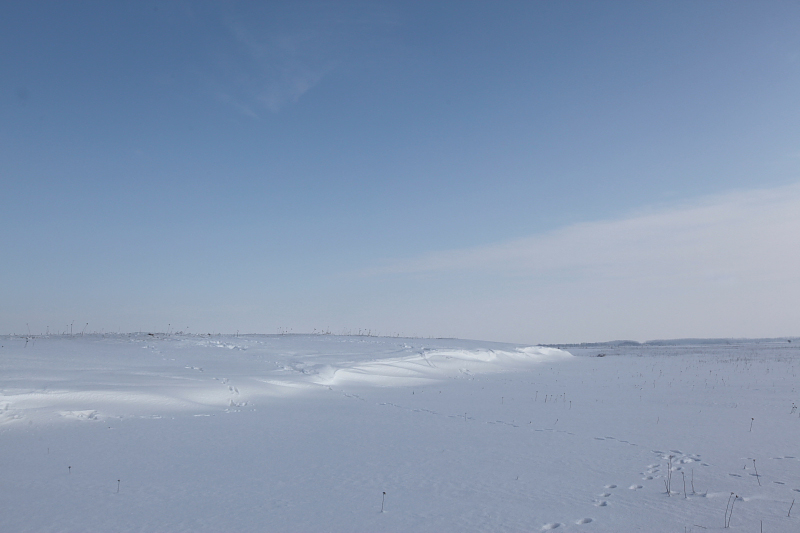
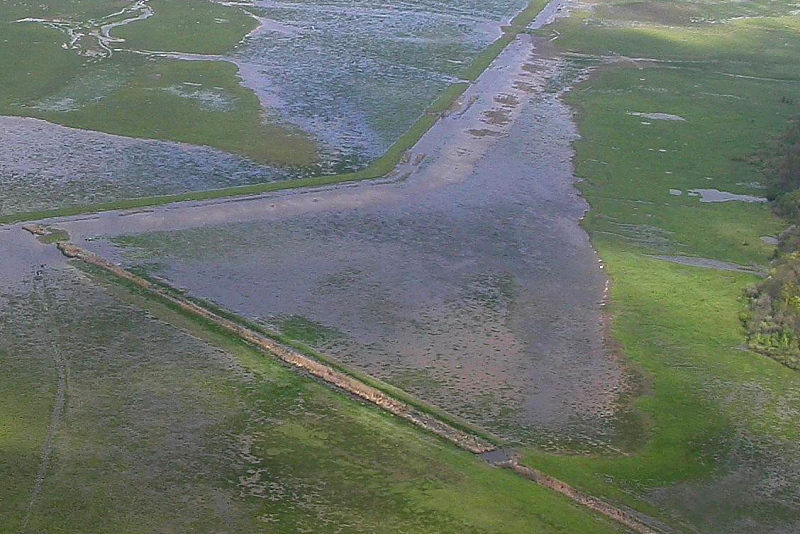
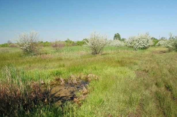
Photos: It is a very important task to defend the extant shorelines of sodic lakes and the replacement of disappeared shorelines. Picture on the left: Shoreline of Magdolna-lapos in winter (Photo: János Oláh); Picture on the right: The original shoreline of Nagy-szik sodic lake can be seen on the right side (Photo: Attila Szilágyi).
In 2009: According to our plan, there has not been any kind of implementation yet.
In 2010: According to our plans, no activities have been due yet. One of our 2010 activities however belongs to this action even though the habitat management came before the actual reconstruction work in this case. Mainly because of the unusually high precipitation in 2010 the deepest part of the sodic lake bed was under 60-100 cm deep water cover (this is natural water and it was not the part of the project to hold back this rainwater) and the already existing marshy vegetation (mainly typha and bolboschoenus) could not be driven back with ecologically high level of grazing. Twice in the vegetation period we cut the marshy vegetation below the surface with a special machine. On the first occasion 7 ha and on the second occasion 2 ha was covered with this machinery work in the deepest part of the sodic lake. In the shallow parts of the lake bed volunteers cut the vegetation by hand (more here). The disappearance of the marshy vegetation definitely helps this action and the ecological factors characterizing sodic pans have improved.
In 2011: We have done machinery and manual cutting of marshy vegetation in the deepest part of the lake bed and in the surroundings. These actions together with targeted grazing have driven back the marshy vegetation. The self-supporting natural sodic pan processes returned on the vegetation-less parts such as the wind-generated (not blocked by standing or floating vegetation) turmoil activities resulting in a turbid water and the evaporation also has accelerated sucking up the salt to the surface. The appearance of the lake is like a sodic pan now (and also the water chemistry characters fall within the sodic pan standard).
The actions were due to start in 2010. The action is now expected to be implemented in the summer of 2012 due to the delay of the approval of the permitted plan. As soon as the final permit for the technical plan is given we will start the selection process to find the suitable contractor and the technical supervisor.

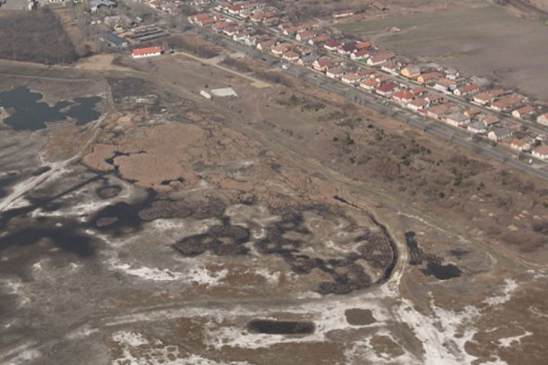
Picture: Aerial image of the project site in April 2011 where the bare, white sodic patches visible (Photo: János Oláh).
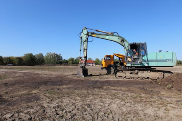
In 2012: By the end of June 2012 we had an approved permitted implementation plan by TIKÖFE and the field works of this action were finally started on the 20th of July in 2012. In map 1 and there is a summary of the realized works in the Nagy-szik. The shoreline bank restoration on the city side is the main work of this action and there was good progress in 2012.
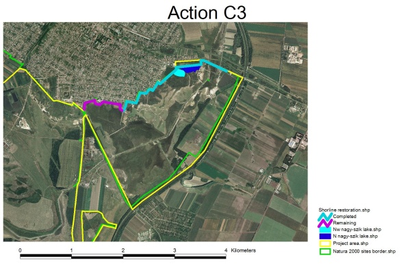
Map 1. Action C3 field works until 31st December 2012 (shoreline bank restoration).
2013: The plans and the intended target of the action has been 100% achieved, which are summarized in the tables and illustrated by pictures below.
Table: Field works of action C3
| Removed and levelled (m3, km) | |
| North Nagy-szik Lake | 20,000 m3 |
| Realized works until 31st December 2013 in the N Nagy-szik Lake | 20,000 m3 |
| Northwest Nagy-szik Lake | 4,500 m3 |
| Realized works until 31st December 2012 in the NW Nagy-szik Lake | 4,500 m3 |
| Nagy-szik Lake shoreline restoration | 3,500 km |
| Realized works until 31st December 2013 of the Nagy-szik shoreline restoration | 3,500 km |
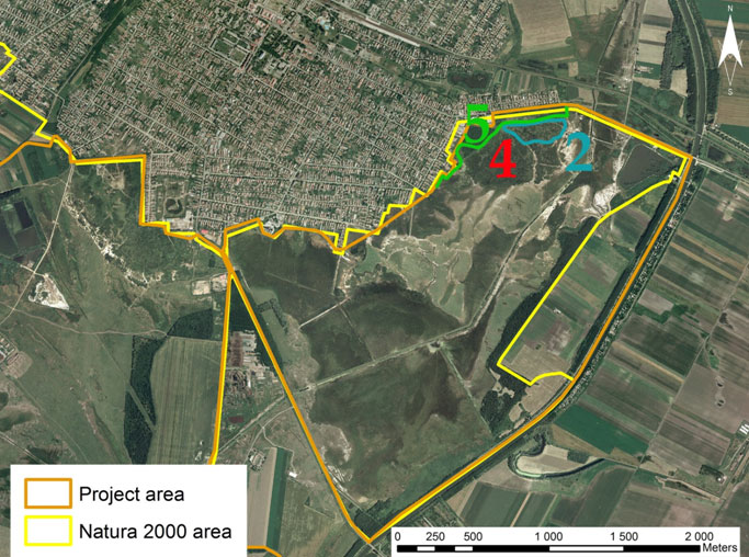
Map 1.: Action C.3 field works until 31st December 2013 (shoreline bank restoration).
Picture: Map 1-1: North Nagy-szik Lake before restoration (‘Nagy-sziki kubik gödör’; total area: 4 hectare)

Picture: Map 1-2: N Nagy-szik Lake after restoration (‘Nagy-sziki kubik gödör’; total area: 4 hectare)
Picture: Map 1-3: NW Nagy-szik Lake before restoration
Picture: Map 1-4:NW Nagy-szik Lake after restoration

Picture: Map 1-5: Nagy-szik Lake shoreline restoration (‘belterület külső töltés’, see also Action C.1 Photo 7.,8.)